Depth Actual
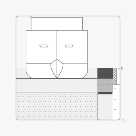
The Depth Actual shows the vessel in cross section, seen from ahead, on the water above the seabed: how deep the vessel lies, and how much water there is below the keel. It is found in the Maritime - OpenBridge section of the Perspective Component Palette as Depth Actual.
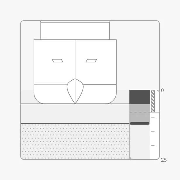
The parts of the instrument:
- Vessel — drawn on the waterline, with its keel at the draught. See Vessel.
- Seabed — the dotted area, starting at the depth. See Depth and Draught.
- Gauge — the bar at the right: dark from the surface to the draught, light from the draught to the depth, with a marker at the depth.
- Scale — the depth scale beside the gauge, with zero at the surface. See Range.
The Depth Actual is one of the maritime instruments, but it has only some
of the shared features: priority, labels and advice zones. It has no state
and no setpoint. See Maritime Instruments — Common Features.
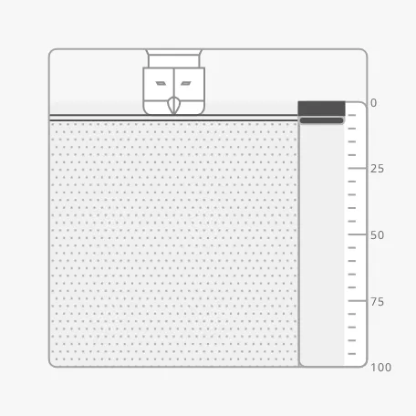
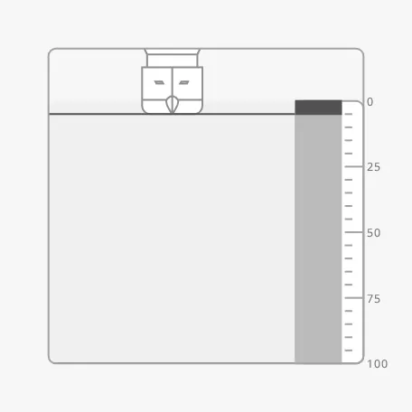
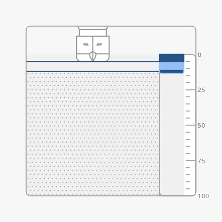
A Depth Actual dropped from the palette has depth and draught 0, on a scale to 100:
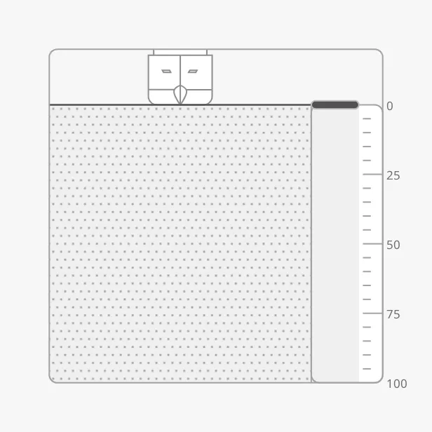
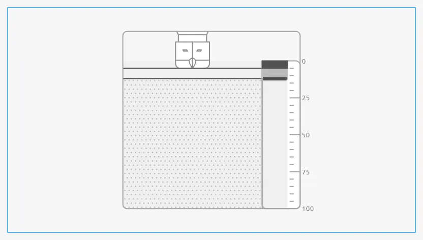
The instrument keeps its proportions and is centred in the component’s box. The blue frame is the component’s box:
Depth and Draught
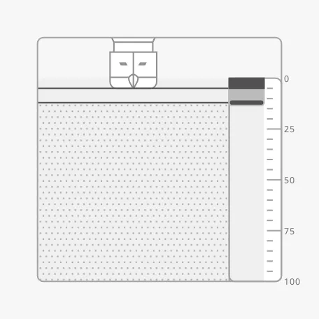
Section titled “Depth and Draught”Bind depth to the depth of the water below the surface, and draft to the
draught of the vessel, both in the unit of the scale (usually metres). The
water below the keel is the light part of the gauge and the space between the
keel line and the seabed:
| Draught 5, depth 12 | Draught 5, depth 7 |
|---|---|
 |
 |
Note that depth is measured from the surface, not from the keel or the
transducer. If your sounder gives the depth below the keel, bind depth to an
expression that adds the draught, for example
{[default]Nav/DepthBelowKeel} + {[default]Nav/Draught}.
Properties
Section titled “Properties”| Name | Description | Property Type |
|---|---|---|
| depth | Depth of the water below the surface. Default 0. |
value |
| draft | Draught of the vessel. Default 0. |
value |
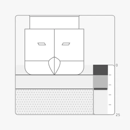
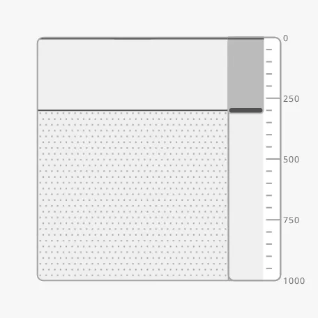
The scale has three ranges: 25, 100 (the default) and 1000. Each range also decides how much air is shown above the waterline and how large the vessel is drawn, so a shallow range shows a large vessel close to the seabed:
| 0 to 25 | 0 to 100 (default) |
|---|---|
 |
|
| 0 to 1000 |
|---|
 |
There are two ways to choose the range:
- Automatically — set
autoRangetotrue. The instrument takes the smallest range that holds the depth. It steps down to a smaller range only once the depth is well inside it (below 70 % of its end), so that a depth near the end of a range does not make the scale jump back and forth. - Fixed — set
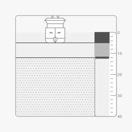
hasMaxDepthtotrueandmaxDepthto the end of the scale. A value that is not 25, 100 or 1000 gives a scale with its own tickmarks, here 40:
autoRange with depth 12 |
maxDepth = 40 |
|---|---|
|
 |
Without either, the scale stays at 100 whatever the depth. A depth beyond the end of the scale fills the whole gauge, and no seabed is drawn:
hasInstrumentRange and instrumentRange are the older names of
hasMaxDepth and maxDepth. Views that use them keep working: a set
instrumentRange other than 0 replaces maxDepth. Use maxDepth in new
views.
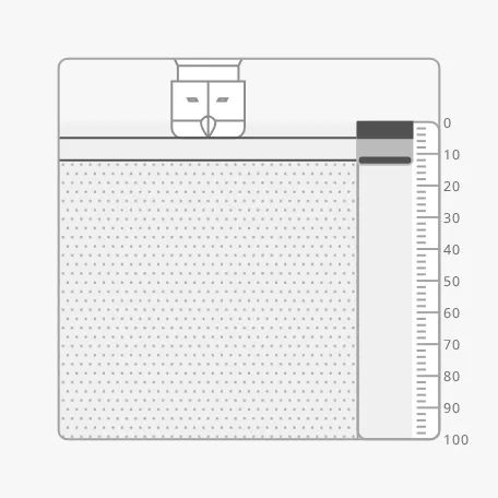
primaryTickmarkInterval and secondaryTickmarkInterval replace the tickmarks
of the range; here 10 and 2 on the scale to 100:
ranges replaces the three ranges with your own list. Each range is an object
with maxDepth (the end of the scale), primaryTickmarkInterval,
secondaryTickmarkInterval, airFraction (the part of the frame above the
waterline, from 0 to 1) and vesselScale (the size of the vessel):
[ { "maxDepth": 20, "primaryTickmarkInterval": 10, "secondaryTickmarkInterval": 2, "airFraction": 0.3, "vesselScale": 5 }]Properties
Section titled “Properties”| Name | Description | Property Type |
|---|---|---|
| autoRange | Choose the range from the depth. Default false. |
value |
| hasMaxDepth | Use a fixed range. Default false. |
value |
| maxDepth | End of the scale. Only shown when hasMaxDepth is true. |
value |
| hasInstrumentRange | Deprecated: older name of hasMaxDepth. Default false. |
value |
| instrumentRange | Deprecated: older name of maxDepth; when set and not 0, replaces it. Only shown when hasInstrumentRange is true. |
value |
| ranges | Your own list of ranges. Empty by default: 25, 100 and 1000. | array |
| hasPrimaryTickmarkInterval | Replace the long, labelled tickmarks of the range. Default false. |
value |
| primaryTickmarkInterval | Distance between the long tickmarks. Only shown when hasPrimaryTickmarkInterval is true. |
value |
| hasSecondaryTickmarkInterval | Replace the short tickmarks of the range. Default false. |
value |
| secondaryTickmarkInterval | Distance between the short tickmarks. Only shown when hasSecondaryTickmarkInterval is true. |
value |
Vessel
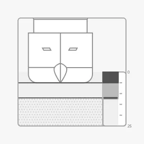
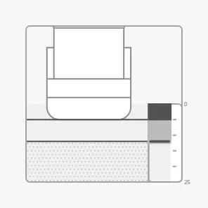
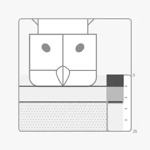
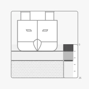
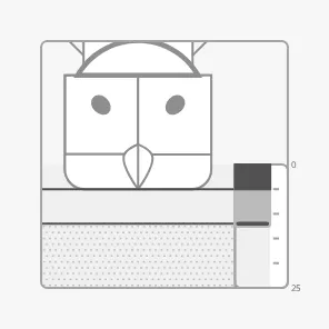
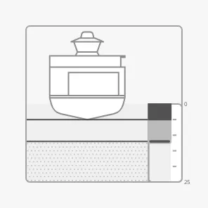
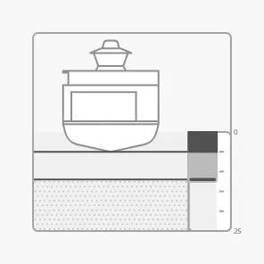
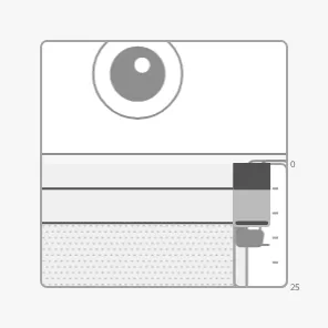
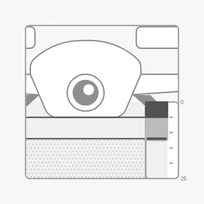
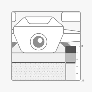
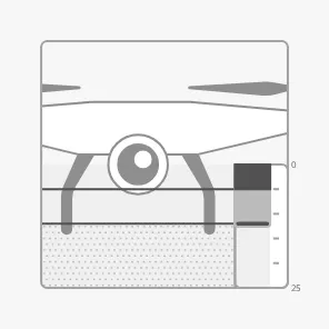
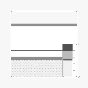
Section titled “Vessel”vesselImage selects the drawing of the vessel. Use one of the views from
ahead (-fore), astern (-aft) or the front (-front), as the instrument is
a cross section; the views from the side and from above are accepted but do not
fit the drawing. The images below use the range 25:
psv-fore (default) |
psv-aft |
cargo-fore |
cargo-wind-fore |
|---|---|---|---|
 |
 |
 |
 |
tanker-fore |
car-ferry-fore |
car-ferry-aft |
rov-front |
|---|---|---|---|
 |
 |
 |
 |
drone-generic-front |
drone-medium-front |
drone-small-front |
generic-side (does not fit) |
|---|---|---|---|
 |
 |
 |
 |
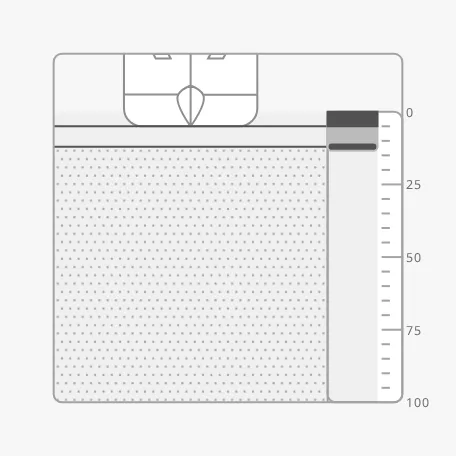
vesselScale enlarges or shrinks the vessel relative to the size the range
gives it:
vesselScale = 1 (default) |
vesselScale = 2 |
|---|---|
|
 |
Properties
Section titled “Properties”| Name | Description | Property Type |
|---|---|---|
| vesselImage | Drawing of the vessel, such as psv-fore. Default psv-fore. |
value |
| vesselImageSrc | Your own vessel image instead of vesselImage. See Custom Vessel Image. |
object |
| vesselScale | Factor on the size of the vessel. Default 1. |
value |
Labels, Advice Zones and Priority
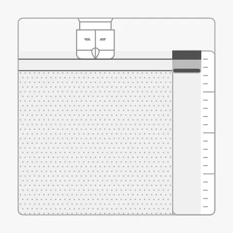
Section titled “Labels, Advice Zones and Priority”showLabels (default true) shows the numbers of the scale. advices is a
list of advice zones on the gauge, with the ends
called min and max, in the unit of the scale. A zone is triggered when the
depth is inside it. priority enhanced draws the gauge in the enhanced
colours.
showLabels = false |
Caution zone from 0 to 8 (range 25) |
|---|---|
 |
 |
priority = enhanced |
|---|
 |
Views made with earlier versions use advice for the list. It still works, but
use advices.
Properties
Section titled “Properties”| Name | Description | Property Type |
|---|---|---|
| showLabels | Show the numbers of the scale. Default true. |
value |
| advices | Advice zones, each with category, min and max (or value) and optionally state. Empty by default. |
array |
| adviceTrigger | Which reading triggers a zone: both (the default) or value for the depth. There is no setpoint, so setpoint triggers none. |
value |
| adviceEmphasis | Apply the design’s emphasis rules; see Advice Zones. Default false. |
value |
| advice | Deprecated, use advices. Applies only when the list is not empty, and then replaces advices. |
array |
| priority | regular or enhanced. Default regular. |
value |
Properties
Section titled “Properties”Properties not covered in the sections above:
| Name | Description | Property Type |
|---|---|---|
| style | Standard Perspective style object. | object |
Component Events
Section titled “Component Events”The Depth Actual has no component events of its own.
Examples
Section titled “Examples”Example 1 — Depth Under the Keel in Harbour
Section titled “Example 1 — Depth Under the Keel in Harbour”- Drop a Depth Actual into the view and make it 300 × 300 px.
- Bind
draftto[default]Nav/Draughtanddepthto{[default]Nav/DepthBelowKeel} + {[default]Nav/Draught}. - Set
autoRangetotrue. - To warn when there is less than 2 m under a 5 m keel, set
advicesto[{"category": "caution", "min": 0, "max": 7}].
Found an error or something unclear?
Tell us what is wrong, confusing or missing on this page.
Built on the OpenBridge Design System